Arquivo digital de mapas de orientação de Eva Jurenikova
|
Log in
Todos utilizadores
|
Língua:
Português
Česky
Dansk
Deutsch
Eesti
English
Español
Français
Italiano
Magyar
Norsk
Polski
Português
Русский
Svenska
Türkçe
Український
|
DOMA 3.0.10
Mostrar mapa geral
Esconder mapa geral
|
KML
|
Voltar
<< Pair exercise Aydat (19-03-2011)
|
3 loops Montlosier (20-03-2011) >>
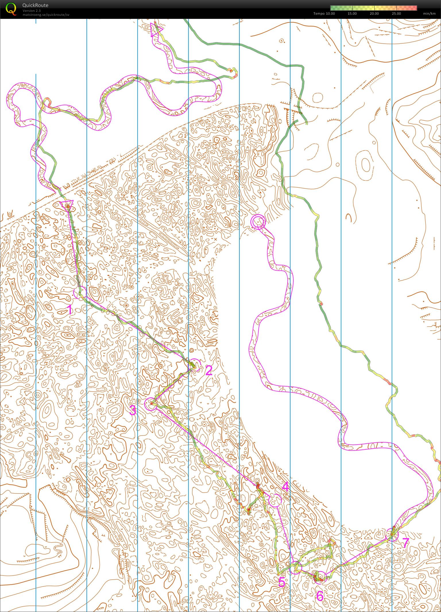
Jegor's map from night training with Thierry, Aydat (19-03-2011)
Categoria:
Training
Mapa/Área:
Clermont-Ferrand
País:
France
Distância:
6.41 km
Tempo:
76:17
3D Rerun
Jegor's 4th training that day. No controls in the forest. The corridor is very narrow. I think there are only a few orienteers in the world who can handle such a course when it is dark.
Mostrar comentários
Esconder comentários
(
0
)
Criar novo comentário
Nome:
Email:
Guardar
 Português
 Česky
Česky Dansk
Dansk Deutsch
 Eesti
Eesti English
 Español
 Français
 Italiano
 Magyar
 Norsk
Norsk Polski
 Русский
 Svenska
 Türkçe
 Український